
Export a layer
After a layer has been edited in the GRIDit database users (who have access) may want to export a layer to use in another software application. There are two ways to export layers:
- One layer at a time.
- Multiple layers at once.
It's important to differentiate that exporting data is not the same as downloading an archived source file that is stored within a layer. Exporting will include any changes made after the layer was created, downloading an archived source file does not.
Exporting a single layer
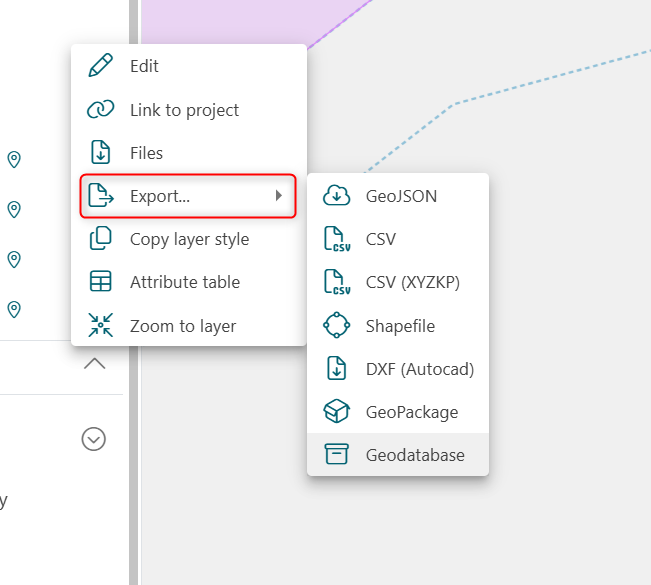
To export a single layer select the layer context menu (...) and then export. Select the format you would like to export to:
Exporting multiple layers
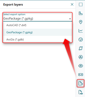
You can also export multiple layers to a variety of formats. This can be done using the Export layers tool (  ).
).
- Select the export layers tool (
 ).
). - Using the mouse cursor, left click an area on the map and drag the rectangle around all items you would like to export.
- Any item that the rectangle partially includes will be made available for export.
- Choose the output format you would like.
- Choose the bathymetry layer and the vector layers you would like to export.
- Select export, the browser will ask the user where to save the file.
Only one bathymetry layer can be exported when using this functionality (along with multiple vector layers).