WFS & WMS (external applications)
External mapping tools & applications can access data via standard interfaces from Open Spatial Consortium.
- WFS (Web Feature Service)
- WMS (Web Map Service)
Each application needs to be configured differently. All applications need to configure the endpoint and the API key.
Information needed (from administrator)
API endpoint
Each project in GRIdit has its own endpoint. Your project/organization administrator can provide it and it has this format
| Protocol | Endpoint |
| WFS | example: https://api.gridit.nl/api/projects/4928f988-8711-4371-b61b-af6b1834c406/WFS |
| WMS | example: https://api.gridit.nl/api/projects/4928f988-8711-4371-b61b-af6b1834c406/WMS |
API key (for security)
Each user has an API key that can be provided by the project/organization administrator. The API key grants the same access rights as the user.
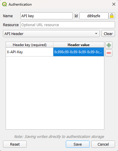
The API key must be provided as part of the http attributes
| Attribute | Value |
| X-API-Key | API Key (eg: 8c898c89-8c89-8c89-8c89-8c898c898c89) |
let url = 'https://api.gridit.web/api/projects/B1C9AE8D-15ED-454C-A91D-CA48C310CE74/WFS?service=wfs&version=2.0.0&request=GetFeature& typeNames=namespace:featuretype';
const response = await fetch( url, {
  method: "GET",
  headers: {
    "X-API-Key": "8c898c89-8c89-8c89-8c89-8c898c898c89",
  },
});
Example in QGIS: