# Private Layers
A private layer can be created by uploading data, or as the result of a calculation within GRID*it*.
The private layers that you create are, by default, only visible from your account. You can choose to share your private layer with colleagues.
As with any other layer, you can adjust the styling of your private layer, and view the attribute table. However, your colleagues cannot see the layer.
### Create a Private Layer by Uploading Data
---
You can drag and drop a file from your explorer into the chart.
For more options, click the + button at the top of the layers menu and you will see the following choices:
- add layer
- add group
- add WMS layer (static image files)
- add WFS layer (vector data)
For information on supported file formats that can be imported, see the Supported formats section of [Add a Layer](https://wiki.app.gridit.nl/books/gridit-user-manual/page/add-a-layer "Add a Layer"). Not, this functionality will be deprecated soon.
### Create a Private Layer From GRID*it* Calculations
---
You can create a private layer by saving the results of the following GRID*it* calculations:
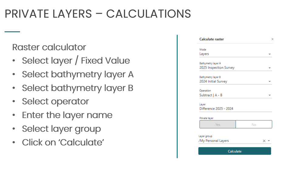
- [Calculate Raster](https://wiki.app.gridit.nl/link/27#bkmrk-calculate-raster)
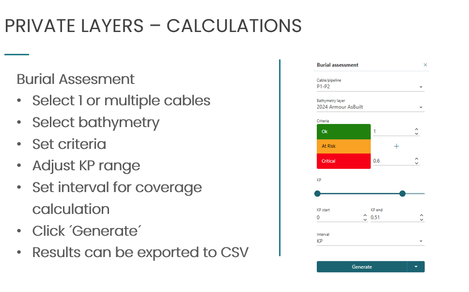
- [Burial (Difference) Assessment](https://wiki.app.gridit.nl/link/27#bkmrk-burial-%28difference%29- "Burial Assessment")
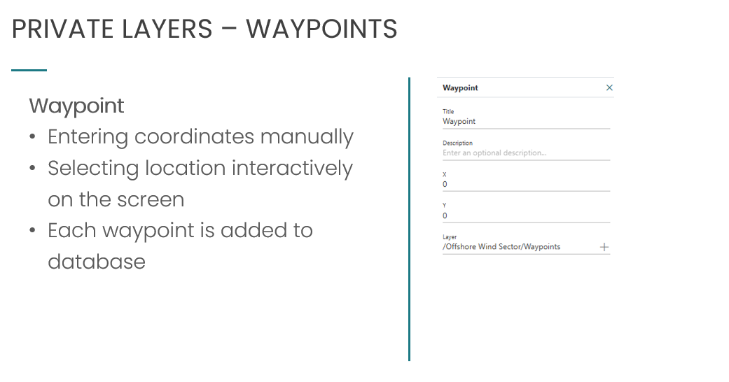
- [Markers](https://wiki.app.gridit.nl/link/27#bkmrk-markers "Markers")
#### Calculate Raster
Add, divide, multiply or subtract the difference between raster layers, then save as a private layer.
[](https://wiki.app.gridit.nl/uploads/images/gallery/2026-03/screenshot-2025-10-29-152914.png)
#### Burial (Difference) Assessment
Calculate the amount of cover above a cable/pipeline then save as a private layer.
[](https://wiki.app.gridit.nl/uploads/images/gallery/2026-03/screenshot-2025-10-29-153032.png)
#### Markers
Enter coordinates manually and save as a private layer.
[](https://wiki.app.gridit.nl/uploads/images/gallery/2026-03/screenshot-2025-10-29-153451.png)